Tag - canyon

Twenty Mule Team Canyon Road 24

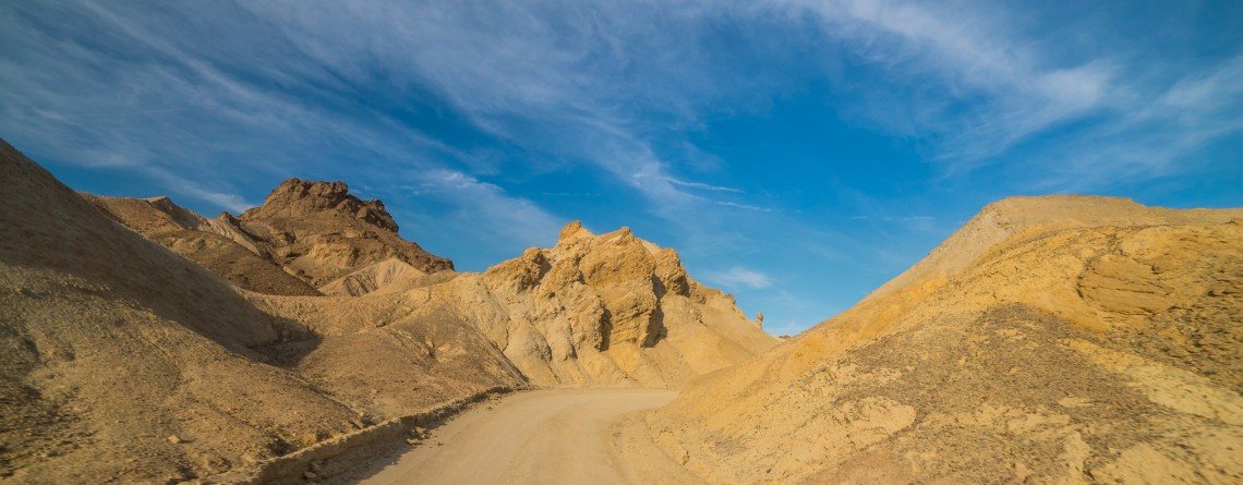
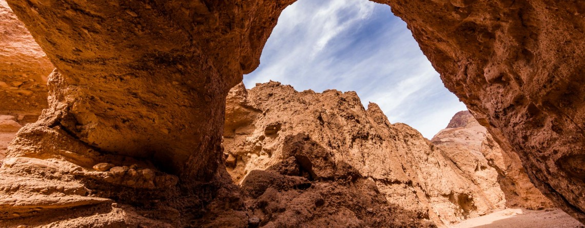
Scenic Drive along 20 Mule Team Canyon Road

  Location: Death Valley National Park, CA Length: 2,8 miles GPS Coordinates: N 36 24.570  W 116 47.680 Contact Information: Death Valley National Park P.O. Box 579 Death Valley, CA 92328   One of the best-known “historic symbols” of Death Valley is the Twenty Mule Teams. Such “teams” were comprised of 18 mules and 2 horses, pulling huge wagons filled with borax, bringing it from mines located in Furnace Creek area to the railhead which was at that time near Mojave. That was an exhausting trip which lasted for 10 days, [...]

Island in Time Trail 41

Island in Time Trail – a harkback to the past

  Location: Sheep Rock Unit, John Day Fossil Beds National Monument, Oregon Roundtrip: 1,3 mile Difficulty: Easy Elevation Gain: 220 feet GPS Coordinates: N 44 35.730 W 119 37.856 Visitor’s Information Open: all year round No Pass Required   Blue Basin is an incredible and unparalleled area of John Day Fossil Beds National Monument. At first glance you see only the beauty and unicity of landscape, the enchantment of the colors, but when you look deeper, you understand the whole historical importance of this place. Its paleontological significance cannot be overestimated. Starting from 1860s, when Thomas [...]

The Narrows 10

The Narrows – an incredibly unique experience for any hiker!

Location: Zion National Park, Utah Length: as long as you wish Difficulty: Moderate GPS Coordinates: N 37 17.798  W 112 56.895   Zion Narrows is among the most incredible and breathtaking adventures in the US. Thousands of people come to Zion National Park in order to challenge themselves with this scenic and adventurous hike. This unique hike at the bottom of a sandstone canyon, the walls of which rise thousands of feet vertically and come as close as twenty feet across at some places is [...]

East Mesa Trail 11

East Mesa Trail (going to Observation Point)

  Location: Zion National Park, Utah Length: 3,3 miles (one way trip) Elevation Gain: 280 feet Difficulty: Moderate GPS Coordinates: N  37 17.819   W  112 54.013 Zion National Park has several overlooks providing the visitors with an amazing panorama of the park’s canyons. One of them is Observation Point, situated at the Eastern Rim of Zion Canyon, at elevation of approximately 6,500 feet. The usual starting point for the hikers, willing to reach Observation Point, is the Weeping Rock Trailhead, which is actually the start [...]

Virgin River 13

Virgin River – a Beautiful Creator of Zion Canyon

  Many thousands of years ago, the Virgin River was making its way to the south, winding in the soft formations of a young Colorado Plateau. Over time, the plateau began to rise, driven by the powerful forces of Earth, and little river had to fight its way through it, "biting" into the rock and washing away particles of gravel and sand "on the way". Thus, thanks to the perseverance and persistence of the Virgin River an amazingly beautiful canyon [...]

Mt. Carmel Highway 15

Zion National Park and the Scenic Drive along Mt. Carmel Highway

  Location: Zion National Park, Utah Address: 1 Zion Park Blvd., State Route 9, Springdale, UT 84767 Phone: (435) 772-3256 GPS coordinates of Zion East Entrance: N 37 13.999 W 112 52.527   Nowadays it is hard to astonish a person with anything. People are satiated with information and colorful pictures. But Nature is a great architect, its imagination is simply inexhaustible, and every time it is able to delight the eyes of an investigative observer with something which makes you to freezes in awe and admiration. Do [...]

Riverside Walk Trail 24

Riverside Walk Trail at Zion National Park

  Location: Zion National Park, Utah Length: 2 miles roundtrip Ascent: 57 feet Difficulty: Easy GPS Coordinates: N 37 17.058 W 112 56.811 The Riverside Walk Trail is an outstanding and fascinating trek in Zion National Park, presenting for the park visitors the breathtaking views of immense stone walls of Zion Canyon as seen from its very bottom, and marvelous views of the Virgin River, flowing along the trail. It’s amazing but the quantity of the trail visitors in summer months reaches three thousand per [...]

Canyon Trail 13

Winding Canyon Trail

Location: Smith Rock State Park Length: 6.5 miles GPS Coordinates: N 44 21.952 W 121 08.233 Smith Rock State Park is a very interesting place, where you can explore and enjoy nature hiking, or look at the park from another prospective – climbing. Canyon Trail is an easy 1.5-mile trail, which at some point it becomes steeper. It winds around Crooked River and provides nice views of the park. This trail also allows hikers to enjoy forested area of the park, probably the only [...]

Natural Bridge Canyon Trail 17

Gorgeous Arch at Natural Bridge Canyon

Location: Death Valley National Park Length: 2 miles roundtrip GPS Coordinates: N 36 16.872 W 116 46.193 Natural Bridge Canyon Trail is one of the most popular in the Death Valley National Park. It is situated closely to Furnace Creek and is not very long. Only a 15-minute hike from the parking lot will take you to a 50-foot-high natural bridge. This arch is a result of erosion, and a great example of how it can create really huge holes in the stones. Natural Bridge Canyon [...]

Bright Angel Trail, South Rim 68

Bright Angel Trail – the Premiere Trail of the Grand Canyon

Location: Grand Canyon, South Rim Round Trip: 19 miles Difficulty: Strenuous Elevation Change: 4,380 feet Highest Point: 6,860 feet (at the trailhead) GPS Coordinates: N 36 3.432 W 112 8.623 Visitor’s Information All year round   The Bright Angel Trail is one of the three trails of the Grand Canyon, which lead to the very Colorado River. Two others are the South Kaibab Trail and the North Kaibab Trail. But the Bright Angel Trail is considered to be in the greatest demand and is the most heavily used trail of the Grand Canyon. And [...]

Cape Royal Trail 12

Cape Royal Trail / North Rim

Location: Grand Canyon, North Rim Round Trip: 0,6 miles GPS Coordinates: N 36 7.339 W 111 56.968 Being less popular among the tourists because of its location, North Rim has so much more to offer its visitors than the South Rim. According the statistics only 10% of the total number of tourists is going to the North Rim. And even less visitors have enough patience to get to its southern end – to Cape Royal. And we may understand why it is so. [...]